|
SURVEYING
Property, ALTA (American Land Title Association), GPS, Topographic
|
|
|
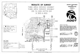
Boundary and ALTA Surveys
JDA takes pride in preparing accurate and thorough boundary surveys, from simple commercial and industrial lots to complex commercial properties encompassing hundreds of acres to surveys of large acreages for agricultural clients. We specialize in ALTA surveys, taking the time to work with title companies and client representatives to ensure all aspects of the property are properly documented on the survey.
|
|
|
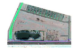
GPS and Topographic Surveys
From large area GPS control network to detailed topographic surveys, JDA provides the mapping services needed for the development of infrastructure and land. Special attention is paid to utility mapping for topographic surveys, with services offered including coordination of utility potholing.
|
|
|
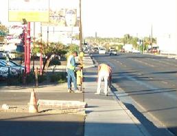
Surveying during Construction
For projects that JDA has designed and for certain selected clients, JDA offers construction staking services.
|
|